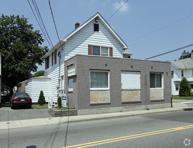
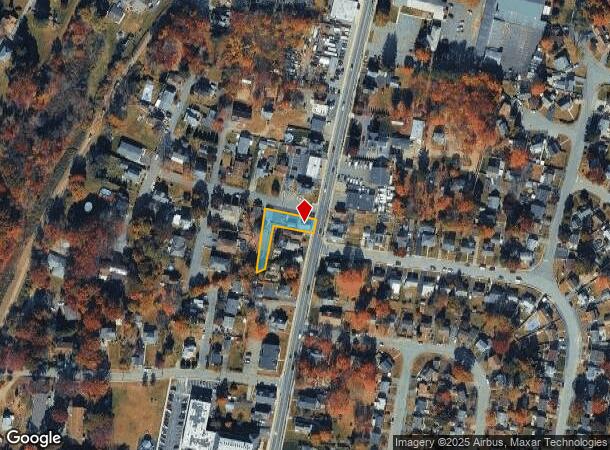
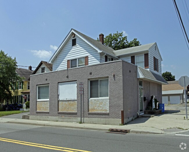
Property Record
915 Ringwood Ave, Haskell, NJ 07420

NEARBY LISTINGS FOR SALE OR LEASE
-
-
-
-
-
No Photo
-
-
-
View all Haskell listings for sale on LoopNet.com
Property Detail
915 Ringwood Ave
New York-Jersey City-White Plains, NY-NJ
INCL BLK 304-01 LOTS 7 & 11
13-00304-01-00007
Passaic
Retailwithmorethanonenonretailuse
New Jersey
X
7
34031C0141G
0.29 AC
2024
Upper Suburban Passaic
2025
Northern New Jersey
236604
DEMOGRAPHICS near 915 Ringwood Ave
1 Mile
3 Mile
5 Mile
2024 Total Population
6,392
35,341
99,060
2029 Population
6,320
35,026
98,521
Pop Growth 2024-2029
(1.13%)
(0.89%)
(0.54%)
Average Age
48
43
43
2024 Total Households
2,573
13,507
36,757
HH Growth 2024-2029
(1.20%)
(1.05%)
(0.73%)
Median Household Inc
$102,266
$107,097
$118,771
Avg Household Size
2.40
2.60
2.60
2024 Avg HH Vehicles
2.00
2.00
2.00
Median Home Value
$331,563
$373,719
$425,777
Median Year Built
1974
1964
1966
Nearby Places
Map Layers
Map Styles
 Street
 Aerial
- Restaurants
- Banks
- Shops
- Fitness
- Groceries
PUBLIC TRANSPORTATION
COMMUTER RAIL
Lincoln Park (Montclair-Boonton Line - NJ Transit Commuter Rail (NJ Transit))
DRIVE
WALK
Distance
Lincoln Park (Montclair-Boonton Line - NJ Transit Commuter Rail (NJ Transit))
14 min
8.5 mi
AIRPORT
Newark Liberty International
DRIVE
WALK
Distance
Newark Liberty International
39 min
32.4 mi
LaGuardia
DRIVE
WALK
Distance
LaGuardia
50 min
36.0 mi
Freight Ports
Port Newark Container Terminal
DRIVE
WALK
Distance
Port Newark Container Terminal
45 min
31.7 mi
Nearby Properties
Address
Land Use
TOTAL SIZE
Lot Size
Zoning
Address
Land Use
TOTAL SIZE
Lot Size
Zoning
Address
Land Use
TOTAL SIZE
Lot Size
Zoning
23.48 AC
Address
Land Use
TOTAL SIZE
Lot Size
Zoning
14.04 AC
B2
Address
Land Use
TOTAL SIZE
Lot Size
Zoning
10.42 AC
B2
Address
Land Use
TOTAL SIZE
Lot Size
Zoning
231.26 AC
PRC
Address
Land Use
TOTAL SIZE
Lot Size
Zoning
7.58 AC
R-4
Address
Land Use
TOTAL SIZE
Lot Size
Zoning
1,675.67 AC
Address
Land Use
TOTAL SIZE
Lot Size
Zoning
Address
Land Use
TOTAL SIZE
Lot Size
Zoning
2.50 AC
B2
Address
Land Use
TOTAL SIZE
Lot Size
Zoning
357,779 SF
16.98 AC
Address
Land Use
TOTAL SIZE
Lot Size
Zoning
434 SF
53.04 AC
I-3
Address
Land Use
TOTAL SIZE
Lot Size
Zoning
4.48 AC
R-6
Address
Land Use
TOTAL SIZE
Lot Size
Zoning
14.40 AC
Address
Land Use
TOTAL SIZE
Lot Size
Zoning
3.43 AC
B2
Address
Land Use
TOTAL SIZE
Lot Size
Zoning
Address
Land Use
TOTAL SIZE
Lot Size
Zoning
44.65 AC
I-3
Address
Land Use
TOTAL SIZE
Lot Size
Zoning
8.33 AC
R-4
Address
Land Use
TOTAL SIZE
Lot Size
Zoning
26.10 AC
R15
Address
Land Use
TOTAL SIZE
Lot Size
Zoning
2.20 AC
B-2
Address
Land Use
TOTAL SIZE
Lot Size
Zoning
5.26 AC
RA3
Address
Land Use
TOTAL SIZE
Lot Size
Zoning
196.40 AC
C
Address
Land Use
TOTAL SIZE
Lot Size
Zoning
2.89 AC
B2
Address
Land Use
TOTAL SIZE
Lot Size
Zoning
4.20 AC
RA3
Address
Land Use
TOTAL SIZE
Lot Size
Zoning
1.28 AC
R-4
Address
Land Use
TOTAL SIZE
Lot Size
Zoning
166 AC
C
Address
Land Use
TOTAL SIZE
Lot Size
Zoning
37 AC
R-20
Address
Land Use
TOTAL SIZE
Lot Size
Zoning
7.97 AC
RA2
Address
Land Use
TOTAL SIZE
Lot Size
Zoning
1,089 SF
2.53 AC
I3
Address
Land Use
TOTAL SIZE
Lot Size
Zoning
1.84 AC
R-1
Address
Land Use
TOTAL SIZE
Lot Size
Zoning
3.03 AC
CO
The World's #1 Commercial Real Estate Marketplace
Connect with us
© 2025 CoStar Group
The information above has been obtained from sources believed reliable. While we do not doubt its accuracy we have not verified it and make no guarantee, warranty or representation about it. It is your responsibility to independently confirm its accuracy and completeness. Any projections, opinions, assumptions, or estimates used are for example only and do not represent the current or future performance of the property. The value of this transaction to you depends on tax and other factors which should be evaluated by your tax, financial, and legal advisors. You and your advisors should conduct a careful, independent investigation of the property to determine to your satisfaction the suitability of the property for your needs.